Cranfield University involves the combination of various geospatial datasets.
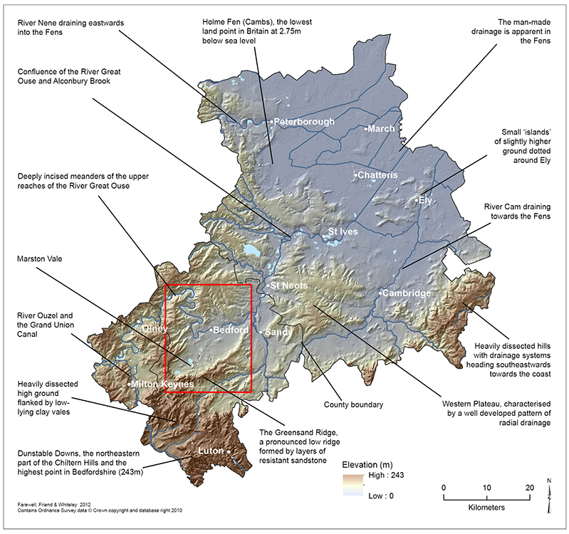
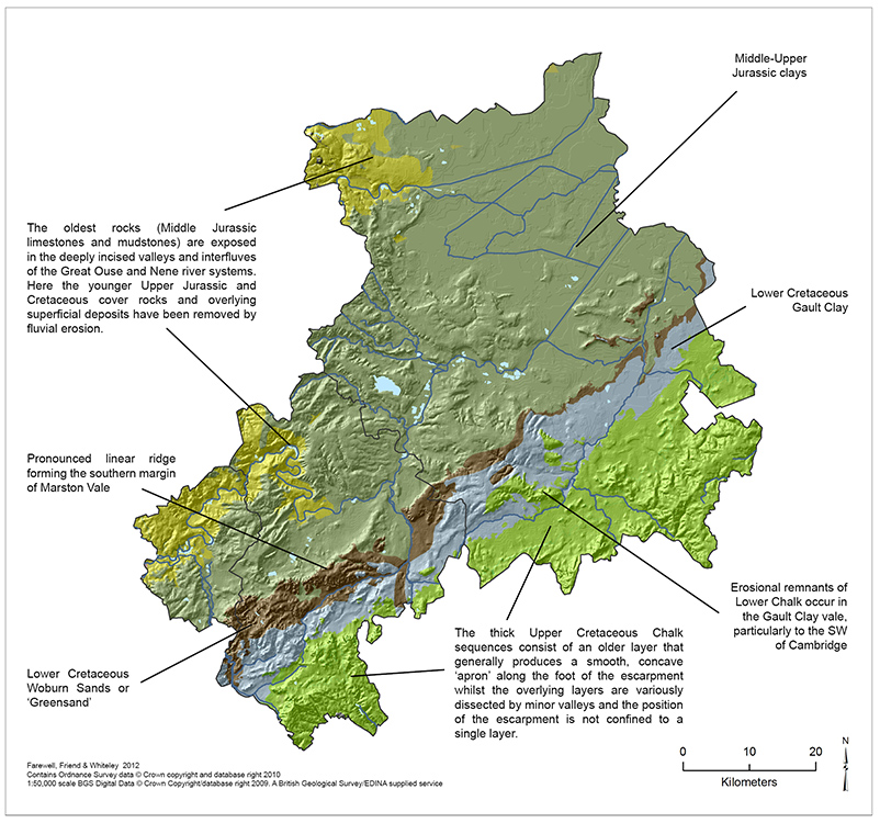
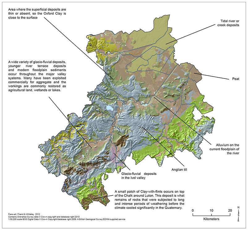
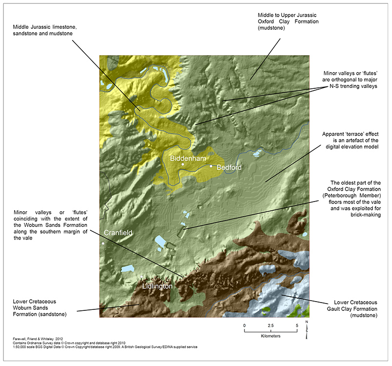
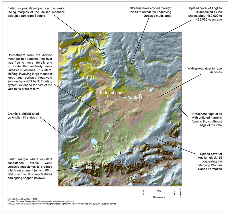
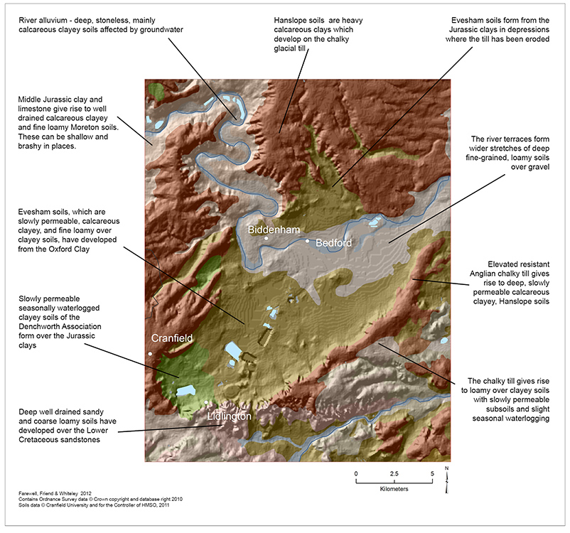
In this project, we were aiming to more effectively understand the landscape and geomorphology of Bedfordshire, Cambridgeshire and Milton Keynes. We produced a hillshaded digital terrain model from Ordnance Survey Panorama data, and draped this with BGS’s geology maps and our own soils data. The results have just been published in Geoscientist, the popular monthly colour magazine for Fellows of the Geological Society of London.
Timothy Farewell, Peter Friend & Martin Whiteley (2013). Lie of the Land. Geoscientist, 23(2), 14-19.
 If you’re not a member of the Geological Society you can access the article via their website. The larger maps are also available here, as a PDF]]>
Cranfield University GeoThread Blog