


 There is a lot of interest in the area of virtual reality and visualisation of synthetic environments here at Cranfield University. A few years ago now, Cranfield University was fortunate to receive support from the UK Natural Environment Research Council, NERC (Natural Environment Research Council) Big Data Capital Equipment Award (NE/LO12774/1) which provided for a state-of-the-art virtual reality suite comprising of a 3D projection system. This award included a 3D software package called Geovisionary from the company Virtalis.
Geovisionary offers a participatory experience in virtual reality; a back-projection system throws up images on a screen for a group of people to see together using 3D goggles. Geothread has a post about the use of this system and a video of it in use.
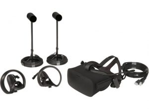
However, for a more immediate experience, a virtual reality headset is required. Our facility has now taken delivery of the amazing Oculus Rift environment. With the ‘Rift’, one wears a full headset with high-resolution stereo viewing screens, together with built in headphones. Orientation is achieved through a range of hard controllers, from the basic controller which is rather like a TV remote control, to a gaming Xbox controller, to the new 3D hand controllers which come in pairs and allow really intuitive hand gestures. These gestures can include actions such as picking up items and even throwing items (use of the retaining cord is advised!)
There are a wide range of apps available which use virtual reality, from the obvious games, to personal productivity tools, data visualisation and spatial data interaction.
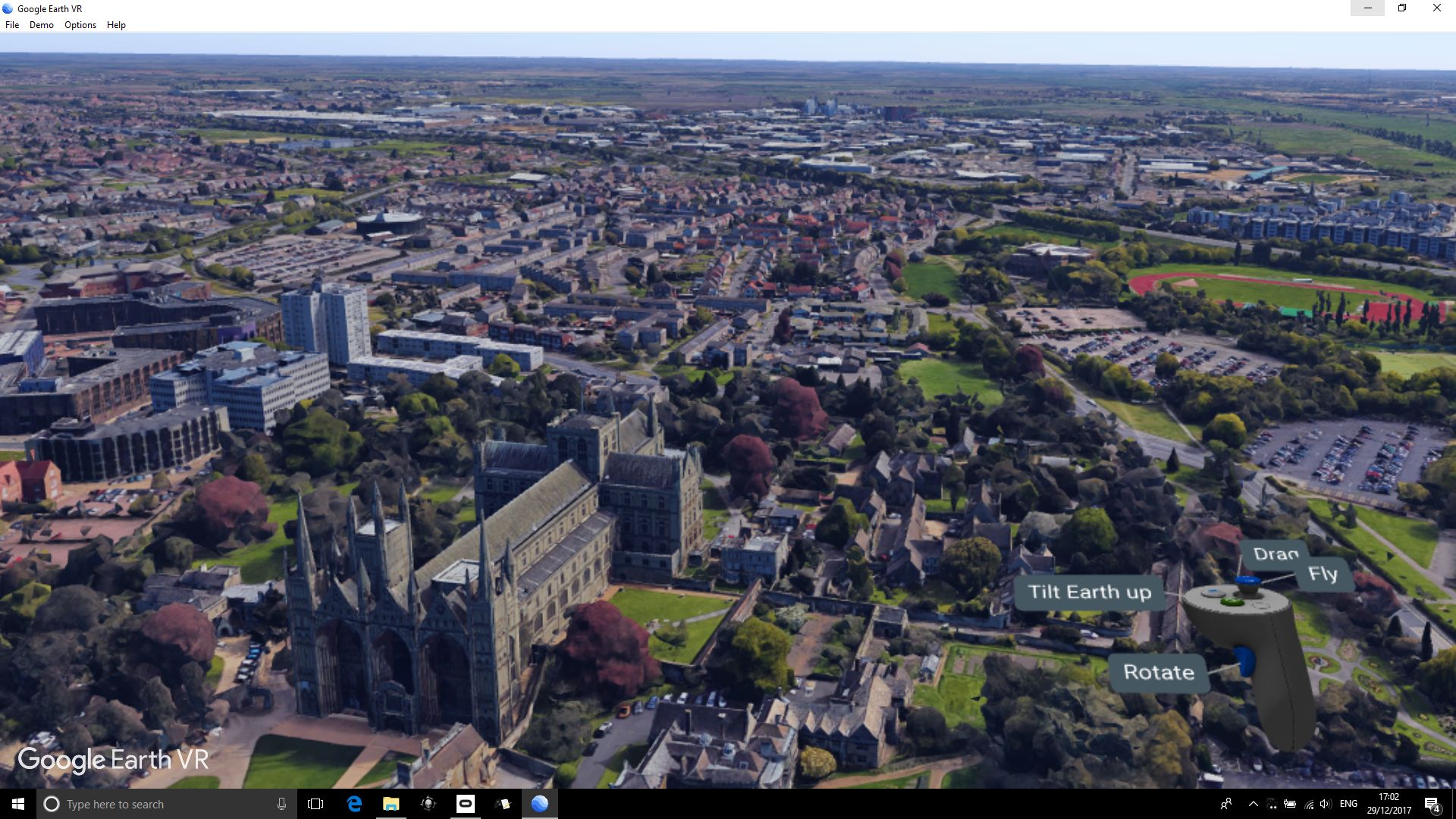
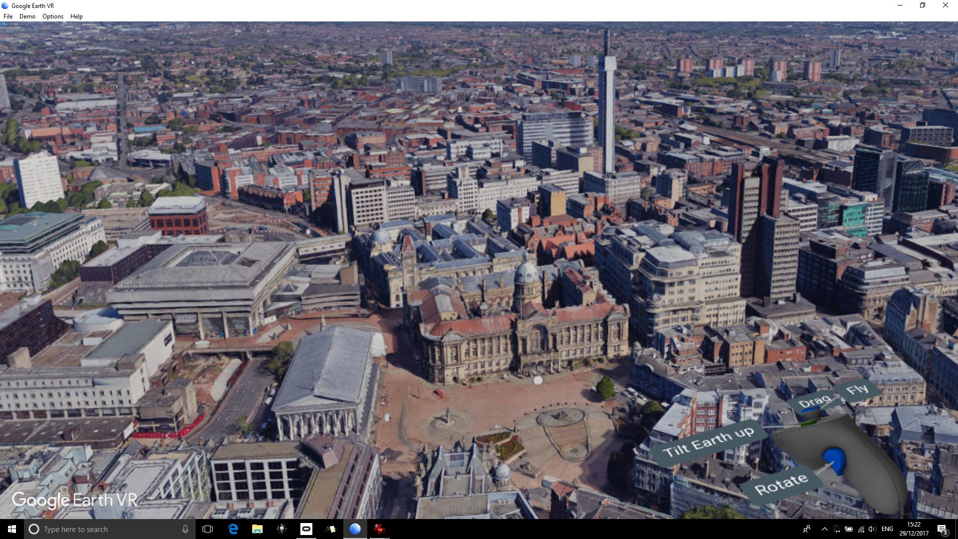
Perhaps one of the most exhilarating experiences for those with cartographic interests is the port of the Google Earth app to the Oculus Rift. This places you apparently literally within 3D city landscapes, and in natural environments – with the most intuitive ability to zoom and fly around. A special mode enforces ‘human scale’ viewing – meaning you can ‘walk’ along streets, viewing the world around you really as if you were there – completely amazing!
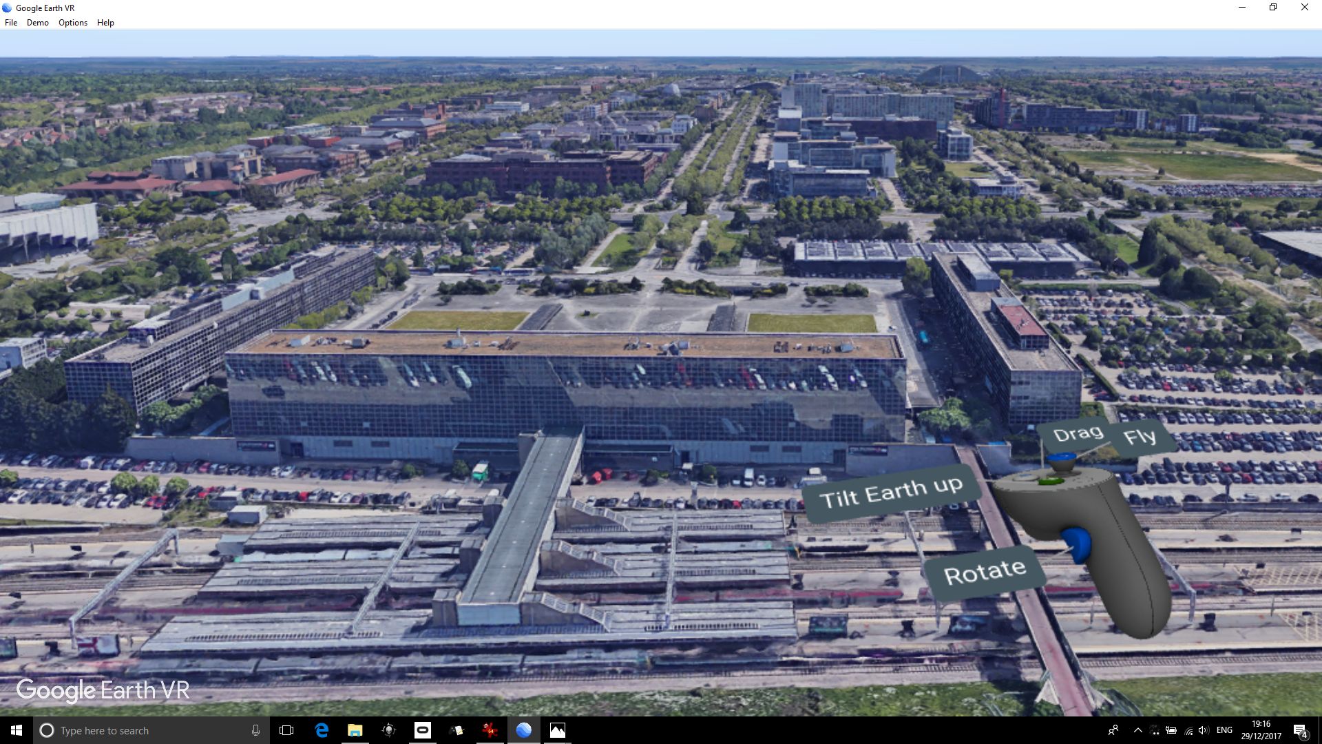
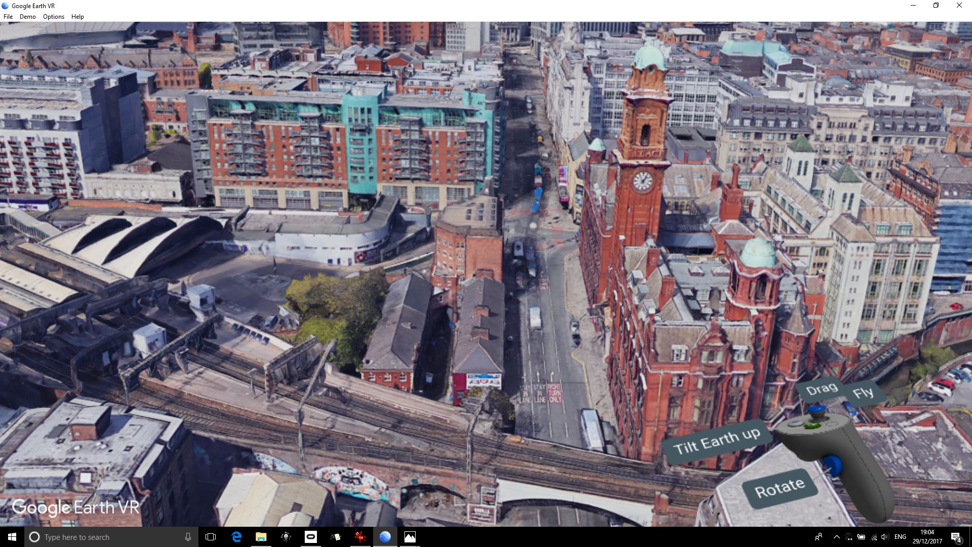
Here are some screenshots of city scapes captured from the system to give an impression of the experience. Views are shown respectively of Milton Keynes, Manchester, Bristol, Peterborough and Birmingham.
This approach was recently used successfully to support the publication of a Smart City frameworks paper:
Sally P. Caird & Stephen H. Hallett (2018) Towards evaluation design for smart city development, Journal of Urban Design, DOI: https://doi.org/10.1080/13574809.2018.1469402.
There is a lot of interest in the area of virtual reality and visualisation of synthetic environments here at Cranfield University. A few years ago now, Cranfield University was fortunate to receive support from the UK Natural Environment Research Council, NERC (Natural Environment Research Council) Big Data Capital Equipment Award (NE/LO12774/1) which provided for a state-of-the-art virtual reality suite comprising of a 3D projection system. This award included a 3D software package called Geovisionary from the company Virtalis.
Geovisionary offers a participatory experience in virtual reality; a back-projection system throws up images on a screen for a group of people to see together using 3D goggles. Geothread has a post about the use of this system and a video of it in use.
However, for a more immediate experience, a virtual reality headset is required. Our facility has now taken delivery of the amazing Oculus Rift environment. With the ‘Rift’, one wears a full headset with high-resolution stereo viewing screens, together with built in headphones. Orientation is achieved through a range of hard controllers, from the basic controller which is rather like a TV remote control, to a gaming Xbox controller, to the new 3D hand controllers which come in pairs and allow really intuitive hand gestures. These gestures can include actions such as picking up items and even throwing items (use of the retaining cord is advised!)
There are a wide range of apps available which use virtual reality, from the obvious games, to personal productivity tools, data visualisation and spatial data interaction.
Perhaps one of the most exhilarating experiences for those with cartographic interests is the port of the Google Earth app to the Oculus Rift. This places you apparently literally within 3D city landscapes, and in natural environments – with the most intuitive ability to zoom and fly around. A special mode enforces ‘human scale’ viewing – meaning you can ‘walk’ along streets, viewing the world around you really as if you were there – completely amazing!
Here are some screenshots of city scapes captured from the system to give an impression of the experience. Views are shown respectively of Milton Keynes, Manchester, Bristol, Peterborough and Birmingham.
This approach was recently used successfully to support the publication of a Smart City frameworks paper:
Sally P. Caird & Stephen H. Hallett (2018) Towards evaluation design for smart city development, Journal of Urban Design, DOI: https://doi.org/10.1080/13574809.2018.1469402.
 ]]>
]]>
Cranfield University GeoThread Blog