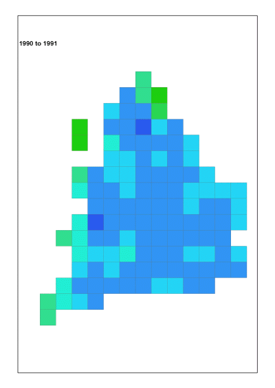
Happy New year from GeoThread.net! The Cranfield University team are all back and picking up respective project threads for the upcoming year. To start the year off, here is an article on improving visualisation for large geospatial datasets through the use of an animated infographic, pictogram map. One useful technique we use to help visualise large, complex datasets is to use animation. In this example, we use the excellent Morecs dataset from the Met Office. This provides us with summary climatic values on a gridded basis, where the grids are 40km x 40km. Morecs data are provided in ASCII text format. This is great as it allows us to use scripting languages such as Perl to process easily through the data. In this case, a Perl script has been used to generate Accumulated Temperatures (AT) below a chosen threshold across England and Wales. The resultant data file is then processed further by a Python script running within the GIS to output ‘frames’ for each of the years in question (23 in our example). These frame maps are created using a set template in the GIS to ensure their visual standardisation. So there are 23 identically sized maps showing a sequence of annual patterns. The resultant map files can therefore be usefully passed on into an animation programme. There are many of these to choose from, but here we used Adobe Fireworks as it allows fine control over each of the image ‘states’. The images are thus stacked up, one for each state, and then once happy with the result the finalised map, an animation (animated gif) can be exported out ready for use. Timings between state changes can also be set. Here’s an example with the frame time delay set to 80 milliseconds.